Share This

Showing posts with label Monsoon. Show all posts

Monday, November 11, 2024

Keeping the virus at bay; Beware the influenza bug, Get the flu vax to stay active again, Protect your workforce during flu season, businesses urged


Stay safe and alert: People wearing face masks to protect themselves in George Town. — LIM BENG TATT/The Star

Keeping the virus at bay

The monsoon season may bring an increase in influenza cases, even in tropical Malaysia. Get vaccinated to avoid contracting the highly contagious virus, say health experts. Business operators, meanwhile, want a safe workplace and to allow flexible options for their staff.

GEORGE TOWN: While the influenza virus tends to thrive during the colder months in countries with four seasons, tropical nations like Malaysia could still face a potential outbreak, says a virologist with Universiti Sains Malaysia (USM).

“Increased rainfall towards the end of the year, particularly in several states across Malaysia recently, often correlates with a rise in influenza cases,” said Dr Kumitaa Theva Das.

With the influenza virus constantly evolving, she noted that medical experts have recommended annual vaccinations to protect against the latest virus strains.

The World Health Organization (WHO) recommends people take the flu jab once every year, in February for those living in the Northern Hemisphere and in September for people in the Southern Hemisphere.

Dr Kumitaa said a common misconception is that influenza, often referred to as the “flu”, is no different from the common cold.

“In reality, influenza is a far more severe respiratory infection that can be life-threatening, especially for the high-risk groups.

“While cold symptoms are usually mild, influenza presents with more intense symptoms, including fever, severe muscle aches and extreme fatigue.

“In some serious cases, individuals may even experience chest pain, shortness of breath and loss of consciousness,” said Dr Kumitaa.

The Institute for Research in Molecular Medicine (Informm) senior lecturer added that some people are particularly susceptible to contracting influenza.

Young children, the elderly, pregnant women, people with chronic health conditions and those with weakened immune systems are all considered to be in the high-risk group, she noted.

“Because their immune systems are either still developing or less resilient, these individuals are at a higher risk of experiencing severe complications from the virus,” she explained.

She also said that influenza is highly contagious, especially during the initial stages when the symptoms begin to show.

An infected person can spread the virus through droplets released when they cough or sneeze, making close-contact environments such as schools and public transportation a prime setting for transmission, she added.

Public health specialist Prof Dr Sharifa Ezat Wan Puteh said influenza could cause pneumonia, adding that pneumonia is one of the leading causes of deaths in the country, especially among women and the elderly.

“Hence vaccinations against influenza are very important, especially among the high-risk groups such as the elderly, young children, disabled, homeless and immune-compromised people like diabetics and cancer patients.

“It could be dangerous for those in the high-risk categories because it could lead to lung complications,” she said.

Dr Sharifa Ezat also urged the government to increase allocations for flu vaccinations, given that they may be costly for the low-income groups.

USM family medicine specialist Dr Mastura Mohd Sopian said certain groups of people, including health workers and infants younger than six months, are at greater risk of developing severe symptoms and complications.

She, too, reminded the public that vaccination is one of the most effective measures against influenza.

There are other simple practices that can help reduce the risk of infection.

“Wash your hands frequently with soap and water to reduce the chance of infection.

“Avoid touching your eyes, nose and mouth as the virus can enter the body through these areas.

“Wear a mask in crowded places or if you are experiencing symptoms. Try to limit contact with individuals who are symptomatic to minimise exposure,” advised Dr Mastura.

Beware the influenza bug

GEORGE TOWN: Achoo! It’s the flu season, and the virus is making its rounds looking for new carriers during this monsoon season.With cases of influenza A or B on the rise, experts are warning of an outbreak as the virus is highly contagious and prone to spreading during the cold climate.

The common symptoms are high fever, body aches, cough or flu, and nobody is safe from the virus unless one is vaccinated.

ALSO READ: Get the flu vax to stay active again

Civil servant K. Charles, 38, was out for lunch when he suddenly felt extremely tired and had shortness of breath.“The feeling was like I got hit by a truck and could not continue riding my bike,” he said.

Charles stopped by the roadside to call his father, who then rushed over and sent him to the hospital.

“I was in bed for five days with a high fever and body aches.

“My test result came back positive for influenza A, which the doctors say is highly infectious and more severe than influenza B.“I was given antiviral drugs for the next few days. I lost my appetite and the doctor put me on intravenous (IV) drips.”

Charles said that after he recovered, he promptly went to take a flu jab.

ALSO READ: Protect your workforce during flu season, businesses urged

Jessie Lim, a clerk, 43, said she accompanied her son Jason Lee, 23, to a private clinic after he complained about feeling feverish and having body aches.

“At first, I thought he was merely having a fever, but to my surprise, his test showed that he had contracted influenza A.

“He was prescribed antibiotics and paracetamols and told to rest and take more fluids,” she said.

As the disease is highly contagious, Lim said everyone in her family wore masks to contain the spread of the virus and kept her son isolated.

Her anxiety did not end there, as Lim’s 76-year-old mother, who lives with them, also came down with fever, flu and cough.

“I was so worried, thinking that the virus had spread among our family members.

“Luckily, my mother later tested negative for influenza A or B. Both of them recovered after a few days.

“A week later, I took both my son and my mum to a clinic to get the flu vaccines for a whole year’s protection,” she said, adding that she herself had gotten vaccinated against the flu earlier.

Imran Hilmy, who works in the media, was not ready to put his eight-year-old daughter’s life on the line again after she recovered from Covid-19.

“When Maryam and her mother contracted Covid-19 during the pandemic, it was really painful for me to see both of them suffer through it.

“With the influenza season raging now, I did not think twice about getting my daughter vaccinated.

“She needs a boost to her immune system, especially during these colder months when both the flu virus and other respiratory illnesses tend to rise,” he said.

General practitoner Dr BS Goh said people of any age can catch the influenza virus.

The viruses that circulate widely in humans are the influenza A subtypes H1N1 and H3N2, along with influenza B, he said.

“Annual vaccination is recommended as this is the primary and most effective way to prevent influenza and influenza-related complications.”

Dr Goh also advised holidaymakers planning to travel to places with colder climates to get the flu jabs before leaving to avoid falling sick later.

Penang health committee chairman Danial Gooi said staying vaccinated will not only protect individuals but also help safeguard the vulnerable folk within the community.

“Parents, too, should be attentive and refrain from sending their children to daycare centres, kindergartens or schools if they are ill,” he added.

Gooi revealed that the cumulative number of influenza clusters in Penang rose to 27 by epidemic week (EW) 41 this year, up from 21 during the same period last year.However, he said the consultation rate for influenza-like illness (ILI) in EW 41 this year had seen a slight decrease from 8.4% in 2023 to 5.4% this year.

“Although the number of cases per influenza outbreak has shown a significant decline with no serious cases detected in any of the outbreaks, the public still needs to be vigilant about their health and seek immediate treatment if they feel unwell,” he said.

Source link

Related stories:

Get the flu vax to stay active again

Protect your workforce during flu season, businesses urged

Wednesday, December 22, 2021

Will it rain or will it shine? Forecasting the weather amid climate change, How extreme weather may lead to food shortages

The Meteorological Department’s weather forecasts are more vital than ever as Malaysia struggles to cope with severe weather events caused by climate change.

Taman Sri Muda in Seksyen 25, Shah Alam, was flooded on Saturday afternoon due to non-stop rain from Friday night. 

 

CLIMATE change is really hitting home this rainy season in Malaysia.

A higher average temperature from a warmer climate means more water is being evaporated from land and sea, which leads to more extreme precipitation. In other words, the warmer it gets in Malaysia, the more rain we’ll get – just as we’re currently experiencing.

But how much more rain are we actually getting?

According to the Malaysian Meteorological

Department – better known as Metmalaysia now – average yearly temperatures between 1981 and 2020 have trended higher at a rate of 0.02ºc every year, which translates to 0.2ºc every decade.

Metmalaysia director-general Muhammad Helmi Abdullah says a rise in 1ºc could translate into a corresponding 7% increase in rainfall. This is according to the Sixth Assessment Report of the United Nations’ Intergovernmental Panel on Climate Change (released in August this year) and Malaysia’s Third National Communication to the panel.

“There has been an increase in the trend of average yearly temperatures although it’s not very drastic. But it can still have an impact on the weather in our country,” he says.

An increase in rainfall, says Muhammad Helmi, can be linked to more extreme thunderstorms which can lead to more frequent flash floods and landslides as well as water and land spouts, and hail.

He points to the 2006/2007 and 2014 massive floods in Johor and Kelantan respectively as examples of incidents of such extreme rainfalls.

Based on Metmalaysia’s observations, Muhammad Helmi says the highest average yearly temperature recorded in the country was in 2016 at 27.84ºc, which was 0.87ºc above normal.

This is followed by 1998, 2019 and 2020, he says. In fact, based on records between 1951 and last year as provided by Met-malaysia, nine of the 10 hottest years in the country have occurred in the past 20 years since 2000, except for 1998 (see graphics with Metmalaysia stats).

“The maximum highest temperature ever recorded in Malaysia was 40.1ºc in Chuping, Perlis, on April 9, 1998,” says Muhammad Helmi.

That year saw one of the most powerful El Ninos in recorded history, during which scientists say air temperature hiked up by 1.5ºc compared with the 0.25ºc usually associated with that global weather phenomenon.

“The rise in temperature can also cause heat waves and haze to become more extreme,” adds Muhammad Helmi.

Malaysians, he says, must realise that natural disasters from the effects of climate change are now unavoidable.

“But with knowledge, planning and early preparation, we can minimise the impact on mortality and property damage.

“Thus, members of the public must be prepared to face any possibility of natural disasters and always get the latest weather update by Metmalaysia in their areas.”

From paper charts to satellite images

With floods and hurricanes increasing, getting the latest weather updates out has become vital – lifesaving, even, when it gives uniformed personnel time to deploy in areas facing disaster. Metmalaysia has had to move with the times over the years to achieve this.

When Muhammad Helmi first joined the country’s Meteorological Department back in the 1980s, predicting the weather was about looking at the charts. Back then, the country didn’t have its own weather forecast models and needed to rely on those produced by other countries to try and predict whether it would be rain or shine the next day.

Muhammad Helmi remembers having to study details of the charts splayed out on tables or pinned up on boards.

“At that time, we had to plot the daily weather by hand,” reminisces the 57-year-old, who was posted to the then Subang International Airport, one of the more important places among his first few postings.

Thankfully, modern technology means predicting the daily weather doesn’t have to be that painstakingly arduous now.

Malaysia now has its own weather forecast models and live satellite images can be displayed on gigantic electronic boards, while staff members work with computer screens and sophisticated seismographs.

When The Star visited Metmalaysia at its headquarters on Jalan Sultan, Petaling Jaya, recently, the images from Japan’s Himawari and China’s Feng Yun satellites were tracking a red dot – a sign of possible inclement weather – across different shades of the blues of the Indian Ocean.

First set up in 1958 as the Malaya Meteorological Service Office at the Simpang Airport in Kuala Lumpur – also known as the Sungai Besi Airbase – the office has undergone various changes as its role expanded.

Originally parked under the Transport Ministry as the Meteorological Service Malaysia in 1965 following Singapore’s departure from the federation, it was shifted to the Science, Technology and Environment Ministry in 1984.

Today, the department’s forecast office sits in an unassuming white building on a site that it has occupied since 1968, from where it keeps an eye out for everything from earthquakes and tsunamis to rain and wind, and even the ultraviolet index and heatwaves during the dry season.

Currently, Metmalaysia has a network of 247 automatic weather stations and 183 manual observation stations to detect data like rainfall, temperature, wind direction and speed, and atmospheric pressure. There are also additional stations to monitor acid deposition, the intensity of surface ultraviolet rays and background particulate matter, surface ozone, and aerosol concentrations.

Despite the advent of technology, though, work hasn’t necessarily become easier for the department, on which much of the country’s agricultural, plantation, aviation and even tourism sectors depend.

Winds of change

During our interview, Muhammad Helmi admits that with climate change, the department’s role has become more onerous and the forecasting work more challenging.

Typically, it’s harder to forecast the weather for a country with a tropical climate like Malaysia than, say, temperate countries like Japan and those in Europe which have four seasons. But it is even more challenging when climate change is wreaking havoc with established weather and wind patterns, much like what is happening with our monsoons.

“We can see a drastic change to our weather, like stronger thunderstorms and more occurrences of phenomena such as water spouts, land spouts and even hail, which used to be rare in the past.

“There’s also been an increase in the number of extreme weather events – an increase in both intensity and frequency,” says Muhammad Helmi.

“This has given rise to new challenges for Metmalaysia because knowledge of such events is currently quite limited.

“The main challenge for us is to determine when and where such high impact or extreme weather events will occur,” he explains.

He adds that the department is still studying the indicators or signs that may lead them to better forecast when and where such extreme weather events are likely to take place.

“An example of such an indicator would be wind patterns. We all know that between August and September this year, the southwest monsoon was weak, a situation known as a monsoon break.

“When a monsoon break happens, the wind blows from various directions and is rather weak, causing many thunderstorms to occur.

“The south-west monsoon was supposed to be a drier period for us. Instead, it was the opposite and we had many thunderstorms that even resulted in flash floods, including what happened in Yan recently,” he explains.

In mid-august, six people died in a landslide and over 1,000 more were affected by severe flash floods following heavy downpours in the district in Kedah.

The rains were so heavy that a water column came gushing down the side of Gunung Jerai while images and video clips of muddied roads, inundated cars, fallen trees and drenched residents went viral on social media.

Too darn hot

While scientists and forecasters agree that global warming is causing the evaporation of more moisture from land and sea, which translates into heavier rainfall, they are still scrambling to better predict extreme weather events.

To better spot indicators that can lead up to these extreme events in the future, Metmalaysia has embarked on a series of measures, including upgrading 60 existing manual observation stations to automatic as well as building new ones, and incorporating extra training for its staff.

Eight new radar stations are slated for completion next year – at Kuala Gula in Perak; Rompin, Temerloh and Cameron Highlands in Pahang; Marang in Terengganu; Kuala Krai in Kelantan; Sibu in Sarawak; and Tawau in Sabah.

“Hopefully, with these new radar stations we will be able to monitor and observe the weather for almost the entirety of Malaysia,” says Muhammad Helmi.

More importantly, the department is in the midst of developing a system capable of forecasting weather a few months in advance or giving projections even up to the year 2100.

This, says Muhammad Helmi, will allow national disaster agencies and water resources management to better plan and take early action in case of floods or droughts.

“The projection of up to 2100 based on the scaled down models of CMIP6 and shared socioeconomic pathways will enable better and more accurate simulations of how our country’s climate will look like in the future,” he says.

Coupled Model Intercomparison Project, or CIMP, which is now in phase six, is a framework which allows climate scientists around the world to collaborate and improve their knowledge on climate change. Coupled models are computer-based models of the Earth’s climate in which the atmosphere, oceans, land or ice are “coupled” together to interact in simulations.

Asked if Metmalaysia will consider recruiting the help of climate scientists to better understand and predict extreme events, Muhammad Helmi says it’s still best to ensure capacity building for its own staff.

“Upon acceptance into the service, our staff members have to undergo a year of training before being posted to a meteorological office for another year or even a few years.

“They will have to work at this meteorological office for at least a year so that they will know what the weather in that particular area is like during the different monsoons.

“They know the weather and climate of this country better because they have been in the field for so long,” he says, adding that the department has recently had one of its officers recognised as a subject matter expert under the civil service scheme.

“We have four more officers on the same career pathway,” he adds.

Moving on up

There are also plans to relocate Metmalaysia’s headquarters away from the narrow, busy street it now shares with the Road Transport Department and the Chemistry Department in PJ to a site in Labu near the KL International Airport by 2024 or 2025.

But even that comes with its own set of problems unique to the department, which operates 24/7 for 365 days every year.

The particular nature of forecasting, stresses Muhammad Helmi, means that Metmalaysia can’t afford to shut down its operations in the country for even one minute.

“Earthquakes and weather changes happen all the time. Much of the department’s operations must already be set up at the new location for, say, a month before we can actually move to the new site.

“We are currently holding workshops to determine our needs at the new building,” he says.

Meanwhile, rain or shine, or hail and hurricanes for that matter, Malaysians must keep up with Metmalaysia’s daily forecasts now that unpredictable weather is the norm. 

- The Star Malaysia21 Dec 2021by SIM LEOI LEOI lifestyle@thestar.com.my 

Forecasting the weather amid climate change


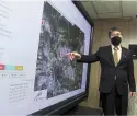
— Photos: IZZRAFIQ alias/the star muhammad Helmi explaining a satellite image at metmalaysia headquarters.
 

The maximum highest temperature ever recorded in Malaysia was 40.1ºc in Chuping, Perlis, on April 9, 1998,” says Muhammad Helmi

That year saw one of the most powerful El Ninos in recorded history, during which scientists say air temperature hiked up by 1.5ºc compared with the 0.25ºc usually associated with that global weather phenomenon.

“The rise in temperature can also cause heat waves and haze to become more extreme,” adds Muhammad Helmi.

Malaysians, he says, must realise that natural disasters from the effects of climate change are now unavoidable.

“But with knowledge, planning and early preparation, we can minimise the impact on mortality and property damage.

“Thus, members of the public must be prepared to face any possibility of natural disasters and always get the latest weather update by Metmalaysia in their areas.”

From paper charts to satellite images

With floods and hurricanes increasing, getting the latest weather updates out has become vital – lifesaving, even, when it gives uniformed personnel time to deploy in areas facing disaster. Metmalaysia has had to move with the times over the years to achieve this.

When Muhammad Helmi first joined the country’s Meteorological Department back in the 1980s, predicting the weather was about looking at the charts. Back then, the country didn’t have its own weather forecast models and needed to rely on those produced by other countries to try and predict whether it would be rain or shine the next day.

Muhammad Helmi remembers having to study details of the charts splayed out on tables or pinned up on boards.

“At that time, we had to plot the daily weather by hand,” reminisces the 57-year-old, who was posted to the then Subang International Airport, one of the more important places among his first few postings.

Thankfully, modern technology means predicting the daily weather doesn’t have to be that painstakingly arduous now.

Malaysia now has its own weather forecast models and live satellite images can be displayed on gigantic electronic boards, while staff members work with computer screens and sophisticated seismographs.

When The Star visited Metmalaysia at its headquarters on Jalan Sultan, Petaling Jaya, recently, the images from Japan’s Himawari and China’s Feng Yun satellites were tracking a red dot – a sign of possible inclement weather – across different shades of the blues of the Indian Ocean.

First set up in 1958 as the Malaya Meteorological Service Office at the Simpang Airport in Kuala Lumpur – also known as the Sungai Besi Airbase – the office has undergone various changes as its role expanded.

Originally parked under the Transport Ministry as the Meteorological Service Malaysia in 1965 following Singapore’s departure from the federation, it was shifted to the Science, Technology and Environment Ministry in 1984.

Today, the department’s forecast office sits in an unassuming white building on a site that it has occupied since 1968, from where it keeps an eye out for everything from earthquakes and tsunamis to rain and wind, and even the ultraviolet index and heatwaves during the dry season.

Currently, Metmalaysia has a network of 247 automatic weather stations and 183 manual observation stations to detect data like rainfall, temperature, wind direction and speed, and atmospheric pressure. There are also additional stations to monitor acid deposition, the intensity of surface ultraviolet rays and background particulate matter, surface ozone, and aerosol concentrations.

Despite the advent of technology, though, work hasn’t necessarily become easier for the department, on which much of the country’s agricultural, plantation, aviation and even tourism sectors depend.

Winds of change

During our interview, Muhammad Helmi admits that with climate change, the department’s role has become more onerous and the forecasting work more challenging.

Typically, it’s harder to forecast the weather for a country with a tropical climate like Malaysia than, say, temperate countries like Japan and those in Europe which have four seasons. But it is even more challenging when climate change is wreaking havoc with established weather and wind patterns, much like what is happening with our monsoons.

“We can see a drastic change to our weather, like stronger thunderstorms and more occurrences of phenomena such as water spouts, land spouts and even hail, which used to be rare in the past.

“There’s also been an increase in the number of extreme weather events – an increase in both intensity and frequency,” says Muhammad Helmi.

“This has given rise to new challenges for Metmalaysia because knowledge of such events is currently quite limited.

“The main challenge for us is to determine when and where such high impact or extreme weather events will occur,” he explains.

He adds that the department is still studying the indicators or signs that may lead them to better forecast when and where such extreme weather events are likely to take place.

“An example of such an indicator would be wind patterns. We all know that between August and September this year, the southwest monsoon was weak, a situation known as a monsoon break.

“When a monsoon break happens, the wind blows from various directions and is rather weak, causing many thunderstorms to occur.

“The south-west monsoon was supposed to be a drier period for us. Instead, it was the opposite and we had many thunderstorms that even resulted in flash floods, including what happened in Yan recently,” he explains.

In mid-august, six people died in a landslide and over 1,000 more were affected by severe flash floods following heavy downpours in the district in Kedah.

The rains were so heavy that a water column came gushing down the side of Gunung Jerai while images and video clips of muddied roads, inundated cars, fallen trees and drenched residents went viral on social media.

Too darn hot

While scientists and forecasters agree that global warming is causing the evaporation of more moisture from land and sea, which translates into heavier rainfall, they are still scrambling to better predict extreme weather events.

To better spot indicators that can lead up to these extreme events in the future, Metmalaysia has embarked on a series of measures, including upgrading 60 existing manual observation stations to automatic as well as building new See page 3 


How extreme weather may lead to food shortages 


IN a world with an increasing human population, climate change may have a serious impact on our ability to grow enough food. — Bloomberg abundance at a fresh fruit stall in a London wholesale market – but how long will it last as the climate crisis continues wreaking havoc on global weather and threatening food production?

Research from as far back as 2007 found that around 30% of year-to-year fluctuations in tonnes of crops grown per hectare were due to changes in the climate. It is remarkable that under these circumstances the global agricultural system has managed to remain fairly robust, and that major food shortages have been rare.

On the other hand, food prices in recent decades have become increasingly volatile. While there are many influences on food prices – including crop yield, weather variations, international trade, speculation in food commodity markets, and land management practices – mostly open trading systems have allowed food shortages in some places to be offset by surpluses and increased production elsewhere.

However, now that the world seems to be moving toward more trade barriers at a time when climate change is intensifying, these stabilising effects may start to fail. Prices could

Without fertiliser, us farm yields would have fallen drastically as soil quality has been decreasing. However, poorer parts of the world do not have the resources to compensate for barren land with fertilisers in the same way. —AFP rise sharply, putting pressure on poor countries and on the budgets of poor people in rich countries.

While crop growth per hectare has increased considerably over the last 50 years, recently the rate of this growth has slowed compared with previous decades. Recent research suggests that up to 30% of the expected increase in growth of European crops has been cancelled out by adverse weather.

But it is worrying that the most pronounced changes tend to be in countries such as those in sub-saharan Africa, including South Africa, that are at high risk of climate impacts on food availability and affordability.

This is particularly clear in the case of barley, maize, millet, pulses, rice and wheat. It seems that the countries most at risk of food shortages are also worst affected by rising temperatures. This seems to bear out the finding from the world’s premier climate science advisers, the Intergovernmental Panel on Climate Change (IPCC), that the higher average global temperatures and more extreme weather events associated with climate change will reduce the reliability of food production. The latest IPCC report, released in August, also supports this conclusion.

Another change noted by the IPCC is how rising heat and rainfall associated with climate change is increasingly degrading land, making soil less productive. This is due to the loss of soil nutrients and organic matter and has negative effects on crop yields.

In addition, accelerating rises in sea levels will compound these negative impacts by increasing saltwater intrusions and permanently flooding crop land.

Recent modelling of soil loss in wheat and maize fields shows large variations between tropical climate regions and regions with a large proportion of flat and dry land, with losses ranging from less than 1 tonne per hectare in central Asia to 100 tonnes per hectare in South-east Asia.

The strong impact of climate and topography on simulated water erosion is clearly shown in the five largest wheat and maize producing countries: in Brazil, China and India, where a large proportion of cropland is in tropical areas, water erosion is relatively high, while in Russia and the United States annual median values are much lower.

However, historically poor management of lands in Europe and the United States has been largely remedied through the increased use of chemical fertilisers and irrigation, which have been able to offset a massive amount of soil degradation.

For example, one study has shown that, without fertiliser, US yields of corn over the past 100 years would have fallen from around seven to a little over one tonne per hectare due to soil quality decreasing. However, fertiliser has enabled yields to be broadly maintained, although at an annual cost to farmers of over Us$0.5bil (Rm2.1bil).

These results have worrying implications for poorer parts of the world where soil quality is decreasing, but which do not have the resources to compensate for this with fertilisers. And the results become more worrying still if this is exacerbated by climate change.

Many aspects of land management for food production have changed in recent decades, including growing different crops, or the same crops in different places, in response to increased temperatures. The overall result of these changes has been greatly increased food yields in many parts of the world, and land managers may be expected to adapt their strategies for changes in the climate.

But if climate change results in simultaneous failure of major crops such as wheat, maize and soybeans in two or more major breadbasket regions (the areas of the world that produce most food), then the risks of price rises making food too expensive in poorer parts of the world could become acute. – The Conversation

- By PAUL EKINS Paul Ekins is professor of Resources and Environmental Policy at University College London. This article is republished from The Conversation under a Creative Commons license.


Related posts:


  Climate concern: The sun rising behind the chimneys of a thermal power station. A recent International Monetary Fund study points out th...
 
 
The Meteorological Department has been providing information and warnings since Dec 11 about the continuous rainfall that caused the massiv...

Check on coming monsoon floods in Penang !


US and China announce surprise climate change agreement


Friday, May 3, 2019

Check on coming monsoon floods in Penang !

Wake-up call: The floods that hit Penang in 2017 exposed its lack of flood mitigation and disaster preparedness.

GEORGE TOWN: The south-west monsoon season is expected to start sometime this month, prompting fears of flooding and falling trees here.

As dark clouds hang over Penang almost every morning now to herald the coming monsoon, talk of flooding in the state assembly sitting on Tuesday led to several lawmakers and the Speaker himself wanting to have a say.

“I am aware that some government agencies belittle the efforts of assemblymen who highlight flooding and other problems.

“As legislators who face the rakyat, they are carrying out their duties and I hope that the relevant agencies will take them seriously and not make fun of them,” said Speaker Datuk Law Choo Kiang during the day’s proceedings.

Lim Siew Khim (PH-Sungai Pinang) told the assembly how she and Ong Ah Teong (PH-Batu Lanchang) suffered verbal insults when visiting flood victims in Kampung Bukit Dumbar, where homes were flooded seven times, including a few days before the recent Chinese New Year.

This led to Dr Norlela Ariffin (PH-Penanti), Ong and Teh Lai Heng (PH-Komtar) to also stand up and voice their grouses.

Outside the hall, Ong said government officers handling flood problems tend to ignore the pleas of assemblymen.

“We are all in the same WhatsApp groups. When we highlight floods, they never respond,” he said.

Teh told the assembly that government officers don’t face the residents but the assemblymen bear all the insults from flood victims in their constituencies.

Dr Norlela said when she attended the monthly district meetings and called for strict enforcement to end the source of floodings such as deforestation, her pleas were often met with silence.

While the Sungai Pinang Flood Mitigation Plan – delayed for 20 years – has begun again with renewed federal funding, many are worried that the south-west monsoon will still bring back the floods this year.

Scientists Sheeba Nettukandy Chenoli and Chai Heng Lim, in a research paper published last November in the “Journal of Atmospheric and Solar-Terrestrial Physics”, found that the onset of the mid-year monsoon will be on May 19 with a standard deviation of eight days.

State Environment Committee chairman Phee Boon Poh said this was the season when rain coinciding with extra high tides fuelled by the super full moon could lead to severe flooding.

“Between May and June, strong winds stir up huge tidal waves that are not safe for small boats,” he said.

A freak storm on Sunday caused several trees to fall on Penang island, one of them in Tanjung Bungah falling on a passing car.

To keep falling trees in check, State Works Committee chairman Zairil Khir Johari said a special committee was ironing out a method to pass the care of public trees from the Public Works Department (JKR) to Penang Island City Council (MBPP).

“JKR specialises in building and caring for roads and bridges but MBPP has a full landscaping team that includes arborists.

“This team has the know-how to care for public trees and recognise diseased trees that must be felled before they become a hazard.

“We are finalising a method for MBPP’s landscapers to have island-wide jurisdiction of roadside trees and be granted access to federal grants for their maintenance,” he said.

By Arnold Loh and R. Sekaran The Star


Read more ..


Expecting the unexpected


Related image


Related posts:


Friday, December 4, 2015

Penang flood aftermath: design pump system needed to drain out water, fix funding snag ...

Good plan needed to drain water from flood-hit areas

PENANG’S drainage system is unable to cope with heavy rain falling within a short period of time, said state Local Government, Traffic Management and Flood Mitigation Committee chairman Chow Kon Yeow.

He said the cause of flooding in the state on Sunday night was due to the “very heavy and continuous downpour”.

“In Teluk Kumbar, the occurrence of flash floods can only be remedied by the installation of a more efficient pump system with a higher capacity to drain the water out from the affected area during high tides and rain.

“At the moment, a consultant has already been appointed to come up with the design in a few months for a RM3mil project to upgrade the pump system. Hopefully by the second half of next year, the tender can be called to appoint the contractor to carry out the installation.

“A detailed design is also being drawn up for a RM7.5mil flood mitigation project, approved by the state, in order to upgrade the drainage of Sungai Nipah, Sungai Teluk Kumbar and Sungai Relau,” he said at the launching of the ‘Pedestrian is King’ campaign at Town Hall yesterday.

Chow added that the Irrigation and Drainage Department (DID) had also ordered a developer to clear the clogged drains at its project site in Batu Maung that had allegedly caused a mudslide.

He said the areas affected by the downpour from 7.30pm onwards were Sungai Tiram, Relau, Teluk Kumbar, Bandar Baru Bayan, Kampung Seronok and Batu Maung as well as roads including Jalan Mahsuri, Jalan Tengah and Jalan Sultan Azlan Shah.

“The Sungai Ara catchment also recorded 80mm of rain water in a hour. It would be a different outcome if the 80mm downfall took place over two to three hours, instead of within an hour which made the effect more pronounced,” said Chow.

The categorisation of rainfall intensity exceeding 60mm in one hour is considered very heavy according to the DID.

Bayan Baru MP Sim Tze Tzin urged the state government to immediately implement the southwest district flood mitigation masterplan.

“Developers from southwest district have been contributing to flood mitigation funds. Residents also pay their quit rent diligently.

“It is only fair to start using these drainage contribution funds to upgrade drainage infrastructures within the area,” he said.

Call to fix Penang’s flood funding snag


PENANG will carry improvements on the drainage and irrigation systems if it had the money, said state Local Government, Traffic Management and Flood Mitigation Committee chairman Chow Kon Yeow.

“In the 11th Malaysia Plan, we applied for more than RM800mil worth of projects but none was approved.

“If we have the money, we will, of course, conduct works on Sungai Pinang, Sungai Junjung, Teluk Kumbar and other places,” he told a press conference at 1st Avenue Mall yesterday.

Commenting on the drainage system in the southwest district that was built in the 70s, Chow asked that funds be given so the state could replace the antiquated system.

“Drainage and irrigation is a joint responsibility of the state and the Federal Governments, moreover, the Irrigation and Drainage Department (DID) is a federal agency.”

Meanwhile, state Housing Committee chairman Jagdeep Singh Deo said it was imperative that Sungai Pinang be deepened and widened as scheduled under Phase II of the flood mitigation project.

“The rainy season has started and we need to start work on the second phase as it involves the areas most effected by flood.

“I sent Natural Resources and Environment Minister Datuk Seri Wan Junaidi Tuanku Jaafar a letter dated Dec 1 to ask for the funds for the project (to be released),” Jagdeep, the representative for the constituency, told a press conference.

“The state has done its part and relocated the residents in Sungai Pinang.

“We want the Federal Government to be committed to carry out the RM450mil Sungai Pinang Phase II flood mitigation project.”

Under Phase 1 of the project, the river was widened and deepened from Kampung Rawa to the Dhoby Ghaut bridge.

Phase 2 involves, among others, relocating residents to make way for the project and the rehabilitation of the entire river.

Other flood mitigation projects involve Sungai Juru and its basin (RM80mil) as well as restoration works for Sungai Jawi (RM40mil), Sungai Perai (RM35mil) and their basins.

The projects for Bayan Lepas are estimated to cost RM153mil, Sungai Perai (RM35.4mil) and Sungai Kechil in south Seberang Prai (RM12mil).

Odd job worker Nurjan Md Shabdin, whose house is near Sungai Pinang, said she has experienced flooding as high as chest level during the 50 years that she has lived there.

“There are still snakes and monitor lizards that swim into our houses during the floods. My appliances and mattresses have had to be replaced many times,” she said.

Hammad Noor Abdullah, 41, who has lived there since he was 14, said he had to carry his school uniform in a bag and swim to school when the are was flooded.

“I am hoping the Phase II project is carried out and the village is finally free from floods,” he said.

On a separate matter, Chow said the state government had formed a steering committee and four sub- committees to implement the Penang Transport Master Plan.

“We have the Legal and Finance, Technical, Land Use, and the Strategic Communication committees which I head.”

When asked what the plans were for Eastern & Oriental Bhd’s 131 acres of reclaimed offshore land of Gurney Drive for the STP Phase 2, he said the plans had yet to be finalised.

“Part of it will be given to Ewein Zenith Sdn Bhd and there will be a road, green area, linear park and low-density commercial buildings. It’s just a concept now.”

Chow did not rule out a public consultation on the works should there be a need. Reclamation works on the land is expected to start this month.

Separately, Chief Minister Lim Guan Eng claimed that the Federal Government had sidelined the state.

“Penang has been excluded from the Budget over the years and several projects have also been cancelled.

“The state’s application of RM805mil for flood mitigation projects was rejected and promises to build an LRT system to reduce traffic on the roads have not been fulfilled,” Lim said.

“The request for an upgrade of the Penang International Airport was also not given serious consideration.

“I hope the promise to build a multi-storey car park to increase parking capacity at the airport will not become an empty promise,” Lim said in a press statement.

Coping with flood aftermath


Flood water flowing onto the lane in front of the arrival hall of Penang international Airport in Bayan Lepas.

SPRING-CLEANING was the order of the day throughout Penang due to the extraordinary downpour that lasted more than 10 hours and inundated many areas.
Residents living in Permatang Damar Laut Road felt the full brunt of Mother Nature as their houses were filled with mud after the flood.

About 50 residents held a demonstration, blaming the upgrading works along the road for their plight.

“The project has a poor flood mitigation system. Each time it rains, residents know the area will flood,” said housewife Hasiah Md Isa, 57.

Resident Zulkifli Abdullah, 63, said contractors should dig drains alongside their project.

According to Bayan Baru Umno division chief Datuk Mansor Musa, who was present at the demonstration, the Public Works Department (JKR) is undertaking the project.

“We have contacted JKR along with the contractor in charge of this project, asking them to visit the site and explain the situation. It is important for them to identify the cause of the problem.

“We are now requesting that the contractor pay compensation to the residents affected,” he said.

Kampung Sungai Tiram resident Zaliha Yaacob, 28, said the family spent a sleepless night moving their belongings from the rising water.

“We always expect a flood when it rains but we did not expect it to be this bad,” she said while clearing the mess at her home.

Business owner Lau Kok Peng, 60, was also busy cleaning his popular coffee shop.

“It’s a good thing my shop closes on Monday but there’s a lot of work to do,” he said.

In Teluk Kumbar, 44 flood victims from 12 families have left the evacuation centre for home.

Operations officer Lt Muhammad Aizat Abdul Ghani said flood victims began seeking shelter at the Dewan Perda Kampung Masjid Teluk Kumbar from 8.55pm on Sunday.

“They are from Kampung Sulup, Kampung Nelayan and Kampung Seronok.

“They received sufficient supplies from the Welfare Department during their overnight stay,” he said.

On Sunday evening, heavy rain lashed the island and mainland, inundating several low-lying areas.

Traffic came to a crawl as motorists sought safer routes out of flooded roads.

The state recorded 80mm of rain water in an hour from 7.30pm.

Penang Fire and Rescue operation centre head Y. Anbarasan said rescue personnel, including a boat unit, were dispatched as soon as the first flood distress call was received at 9.32pm.

“At 5.10am (yesterday), we evacuated 37 flood victims from 11 families to Dewan Perda Kampung Masjid Teluk Kumbar.

“There were no landslides but two trees fell in Tasek Gelugor and one in Batu Uban,” he said.

At the Pesta site in Sungai Nibong, ankle-deep water forced some operators to close shop early.

Other flooded areas on the island included Jalan Tengah in Bayan Baru, Bukit Jambul, Relau and Batu Maung.

Penang Island City Council Urban Services Department director Mubarak Junus said about 40 staff members were dispatched to help clean up the mud in affected areas including Permatang Damar Laut, Jalan Kampung Bukit and around the Penang Snake Temple in Bayan Lepas.

“We’ve also deployed backup squads to help clean up the roads and drains, and two teams to help in the garbage collection,” he said.

On the mainland, the worst affected areas were Permatang Tinggi as the river bund there broke, causing water from the river to flow into Kampung Permatang Tinggi, Taman Usaha, Taman Usaha Jaya and Taman Pewira.

Seberang Prai Municipal Council president Datuk Maimunah Mohd Sharif said a special squad and six response teams were dispatched to the affected areas on Sunday night.

“Some of the team members stayed until 1am (yesterday) while some stayed on until 3am to monitor the situation. No residents were evicted,” she said.

She said Seberang Prai district received an average 50mm of rainfall.

The Meteorological Department forecasts cloudy mornings followed by thunderstorms in the afternoons and evenings every day for the entire week until Sunday.

A spokesman from the department said the north-east monsoon would cause the northern region of peninsular Malaysia to receive heavy rainfall late in the day until the end of this month.

Also affected was the Penang International Airport which saw the driveway outside the arrival hall flooded.

When contacted, Penang International Airport senior manager Mohd Ariff Jaafar said there was not much discruption to the airport.

“The prior RM1.5mil flood mitigation project involving the installation of an on-site detention tank helped decrease the water during flash floods.

“There was backflow of water from a monsoon drain for two hours in the evening.

“The volume of water increased to about 69mm at 8pm but the water cleared up in less than 30 minutes,” he said in a text message.

Rainy day for commuters

Long journey home: Cars moving at a snail’s pace along the SPICE indoor stadium in Jalan Tun Dr Awang in Bayan Lepas.

GEORGE TOWN: A torrential downpour which lasted about 90 minutes caused flash floods in several areas in Bayan Baru, Bayan Lepas and Relau near here.

Among the worst affected roads yesterday were stretches of Jalan Sultan Azlan Shah, Jalan Tengah and Jalan Mahsuri.

Many vehicles were stalled in the flood waters which rose to about knee high at some places following the heavy rain which began at about 6.30pm.

The situation was so bad at one point that a stretch of Jalan Sultan Azlan Shah in Bayan Lepas was temporarily closed off to traffic in both directions which worsened the traffic congestion already faced by road users.

Among the places where motorists were caught in traffic jams lasting for more than an hour were Jalan Sultan Azlan Shah and Jalan Tun Dr Awang.

The driveway outside the Penang International Airport’s arrival hall and the roundabout leading to the airport were also flooded, causing vehicles to move at a snail’s pace. Some people could have missed their flights due to the floods and traffic congestion.

The Penang Pesta ground was also hit by the floods. The annual fair began on Saturday.

Penang Works Committee chairman Lim Hock Seng, when contacted, said the rainwater could not flow off quickly enough due to the high volume from the heavy rain.

“The drains are also clogged by rubbish. The Penang Island City Council, Public Works Department and Drainage and Irrigation Department are looking into the matter,” he said.

Among the villages flooded were Kampung Sulup in Teluk Kumbar and Kampung Sungai Tiram in Bayan Lepas where the waters rose up to about 0.6m high.

Kampung Sungai Tiram villager Zaliha Yaakob, 28, urged the authorities to solve the flood woes in the village.

Source: The Star/Asia News Network

Related posts:  


Errant hill clearing by developers causes of floods, sinkholes, seepages damaged houses!